ForeFlight users can create User Waypoints using the turn point coordinates. Create the waypoints, then put them together to make the route and save it as a Favorite (instructions on how to do that below). Here's what you should end up with:
Start: 40.03808N
86.25113W
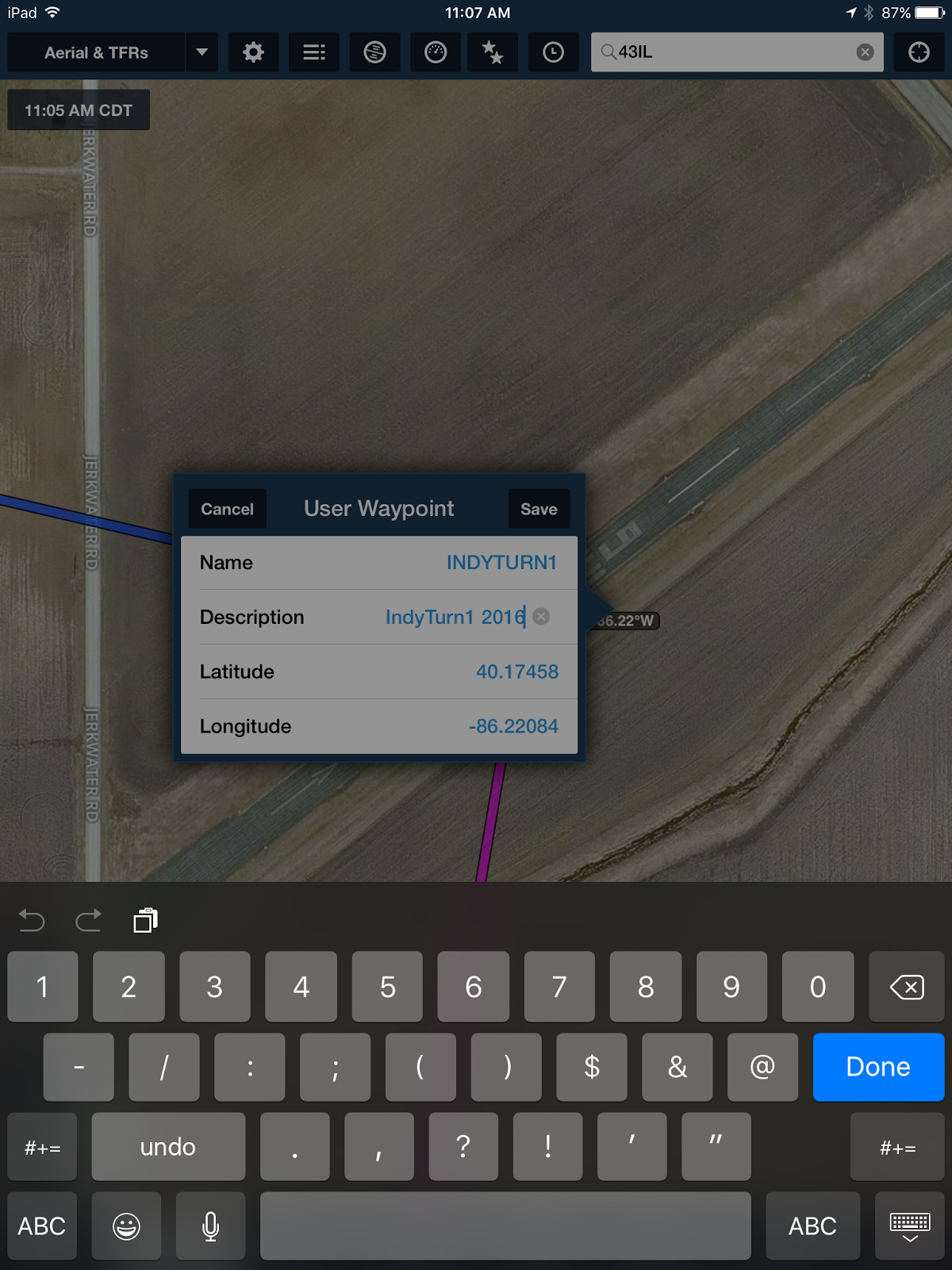
Turn 1: 40.17458N
86.22084W
Turn 2: 40.28487N
86.85311W
Turn 3: 40.08271N
87.26549W
Turn 4: 39.98126N
87.18002W
Turn 5: 39.73896N
87.21904W
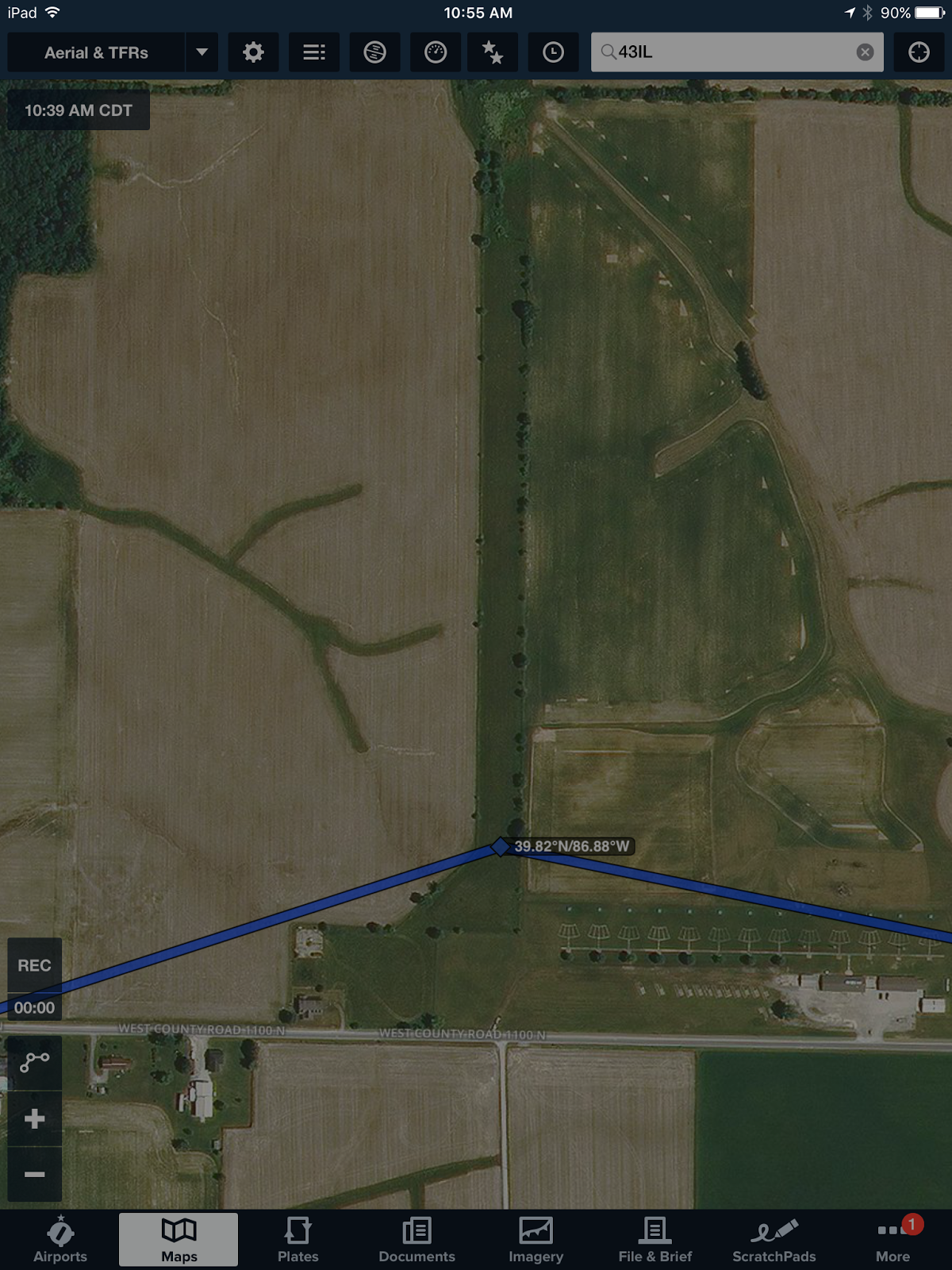
Turn 6: 39.82285N
86.88380W
Turn 7: 39.78026N
86.65873W
Turn 8: 40.00646N
86.43936W
Finish: 40.03112N
86.25090W

START
Start direction will be briefed according to the winds the morning of the race. If we depart to the north it will look like this; if we depart to the south we'll make a left downwind to the Start.
Start coordinates are:
40.03808N
86.25113W
Outbound heading 012


Turn 1 - 123.075
5I4 Sheridan Airport (this is where you separate from Short Course racers)Turn 1 is at the threshold of Runway 5 at Sheridan Airport (5I4).
40.17458N
86.22084W
Outbound heading 289


Turn 2
31IN Timber House
There is a white carport structure about mid field, south of the east-west runway at this private strip. You may see a lot of spectators at this turn point, and maybe even a TV station.
40.28487N
86.85311W
Outbound heading 244
86.85311W
Outbound heading 244


Turn 3
IN55 Songer
Turn 3 is just west of the north end of the airstrip. This is a north-south turf strip south of the town of Veedersburg. Turn at the intersection of the road and the main driveway going to the buildings.
40.08271N
87.26549W
Outbound heading 150
Please see all screen shots for this turn. The Songers have built a large white hangar on the property and you can't miss it. See more current aerial photo which includes large white hangar and be aware that the tower (antenna) at this turn point is 198' so it is not on the charts.


Turn 4 - 122.9
4IN4 Wilson FieldTurn 4 is around the buildings on the north end of Wilson Airport (4IN4)
39.98126N
87.18002W
Outbound heading 192


Turn 5
IN46 Butler Field
Turn 5 is midfield at Butler Field.
39.73896N
87.21904W
Outbound heading 073


Turn 6
IN45 4 Winds Aerodrome
Turn 6 is at the southern end of the field. This is Turn 3 for the Short Course, the converging/rejoin point of the Standard and Short courses. Short Course racers will be coming from the Northeast. ALL racers will call this Turn 6 over the radio.
39.82285N
86.88380W
Outbound heading 103
86.88380W
Outbound heading 103

Turn 7: Fly east to the north side of small pond on the east side of a house. Turn point is DO NOT FLY OVER THE NEXT DOOR NEIGHBOR'S HOUSE TO THE IMMEDIATE SOUTH.
39.78026N
86.65873W
Outbound heading 038
86.65873W
Outbound heading 038
This is my sister's house and she is proud to be the resident of Turn 7 of the 6th Annual Indy Air Race. This turn is called The Lyons' Den. My family and friends will be out waving you on, so let's give them a good show. ALL racers will call this Turn 7 over the radio.

Head north-northeast to just north of the northern most T-Hangars at Boone County Airport (6I4). You must be at or above 2,500' for this turn point - stay above their traffic pattern. ALL racers will call this Turn 8 over the radio.
40.00646N
86.43936W
Outbound heading 082

Turn 8 - 122.8
6I4 Boone County AirportHead north-northeast to just north of the northern most T-Hangars at Boone County Airport (6I4). You must be at or above 2,500' for this turn point - stay above their traffic pattern. ALL racers will call this Turn 8 over the radio.
40.00646N
86.43936W
Outbound heading 082

Finish - 123.05
KTYQ Indy Executive AirportFrom Turn 8, fly east to KTYQ, make a Two Mile Finish Call, and then a Finish Call as you fly your Finish Pass at the Midfield Taxiway at Indy Executive.
40.03112N
86.25090W

After all racers are recovered there will be lunch and awards, and a candy drop for the Downs Syndrome Indiana families. We hope you will choose to participate after the race.
Here are some helpful tips for creating User Waypoints in ForeFlight -
I start by entering airport IDs in the Search Bar, then once my general race route is created I select the Aerial Map to get a good look at the turn point, then drag the magenta line there and save the Lat/Lon with a Name and Description. This is called "rubberbanding" and pulls the magenta line to the exact spots for each turn point, saving the Lat/Lon in place of the airport ID.
After I've created all my User Waypoints, saved and named them, I create a Route in the NavLog in Edit Mode.

Then, I "Favorite" the Route by tapping the single star that is to the right of the suitcase (Pack) icon. I named this one INDYAIRRACE2016. This makes it available in my Favorites so I can get to it any time by tapping the double stars at the very top, about the middle.

No comments:
Post a Comment